/-84.764431,33.546467,12/300x186@2x?access_token=pk.eyJ1IjoibHpjYW11dGkiLCJhIjoiY2o3a281dWJvMHE4ajMzbGF4enJyNHRiciJ9.DhYjvPk5E_wJvys5DU5v2A)
Land Cover Reveals Strong Identities
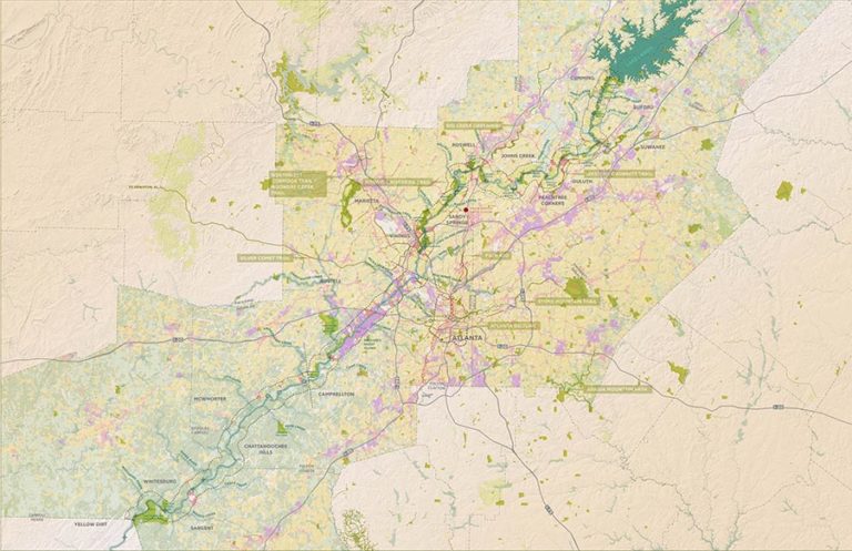
The Greenway Study area benefits from strong recreational anchors at either end – Lake Lanier is a regional recreation destination, and Chattahoochee Bend State Park is one of Georgia’s largest state parks, with 5 miles of river frontage. The Greenway Study represents a clear opportunity to improve connectivity and access between these anchors and the public landholdings that span the River, transforming the River from a barrier to a connector of public resources.
Land cover data reveals distinct characteristics and identities along the River. Sub-Area 1, north of Peachtree Creek, is relatively dominated by residential land and holds a significant portion of publicly owned land, creating opportunities for the Greenway study to connect separated parcels. Sub-Area 3 is primarily comprised of active agricultural and forested areas and fewer public land holdings. The land uses in Sub- Area 3 tend to occupy larger tracts of land and many are privately owned by a small number of individuals, indicating the need to think creatively about greenway development and strategic points for water access. Sub-Area 2, on either side of I-20, is mainly a mix of industrially-zoned land, as well as utility easements. This portion of the River presents a different set of design challenges in terms of access and experience, with MRPA protections creating forested buffers that should be carefully considered for trail planning. In each of these three Sub-Areas, it will be important for the greenway segments and associated amenities to respect and honor the characteristics of the surrounding land uses while creating an iconic identity for the corridor, making it a destination that highlights the assets of the greater region.