/-84.075692,34.162439,12/300x186@2x?access_token=pk.eyJ1IjoibHpjYW11dGkiLCJhIjoiY2o3a281dWJvMHE4ajMzbGF4enJyNHRiciJ9.DhYjvPk5E_wJvys5DU5v2A)
The RiverLands in Numbers
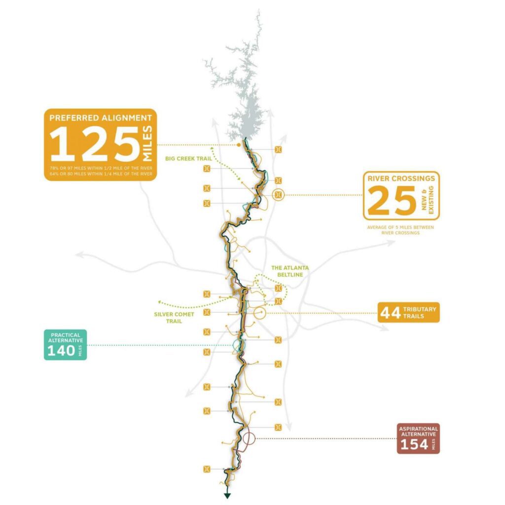
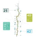
The Chattahoochee RiverLands Greenway spans 125 miles from Buford Dam to Chattahoochee Bend State Park
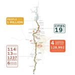
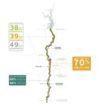
Most of the Greenway hugs the River’s edge, with two-thirds of the Preferred Alignment within a 10-minute walk of the River and the entire Greenway within a 15-minute bike ride of the River’s edge. The Preferred Alignment crosses the River 25 times, an average of 5 miles between river crossings. 60% of the Preferred Alignment runs on the west side of the Chattahoochee while 40% or 49 miles are being proposed on the east side. The RiverLands proposes 44 tributary trails connecting communities to the River and to one-an-other. Alternative alignments include the Practical Alternative spanning 140 miles, and a suite of other alternatives spanning 154 miles in length.
In addition, to the Tributary Trails, the RiverLands will connect to 6 trails of regional significance, including:
- Silver Comet Trail
- Rottenwood Creek Trail
- Bob Callan Trail
- Big Creek Trail
- Mableton Parkway Trail
- The Atlanta Beltline