/-84.098646,34.051096,12/300x186@2x?access_token=pk.eyJ1IjoibHpjYW11dGkiLCJhIjoiY2o3a281dWJvMHE4ajMzbGF4enJyNHRiciJ9.DhYjvPk5E_wJvys5DU5v2A)
Land Use Patterns
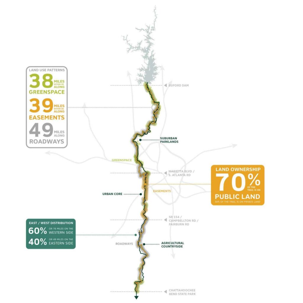
The Preferred Alignment for the Chattahoochee RiverLands Greenway weaves together existing and new infrastructure to create a continuous public realm
The existing infrastructure includes parks and greenspaces, roads, easements, public lands and minimal use of private lands. The trail connects east and west banks of the River, sometimes runs on both sides, with a slight preference to the western banks in the Agricultural Countryside and a slight preference to the eastern banks in the Suburban Parklands.
The Preferred Alignment takes advantage of existing bike infrastructure and runs along 49 miles of roadways while 39 miles are along existing easements and 38 miles along parks and greenspaces. 20 miles of the Preferred Alignment are along or within the Chattahoochee River National Recreation Area boundaries.
70% of the Preferred Alignment, or approximately 87 miles of the trail, is aligned within land that is currently publicly owned.