
Accessing the RiverLands
The Chattahoochee RiverLands will connect communities along the river and the metro region
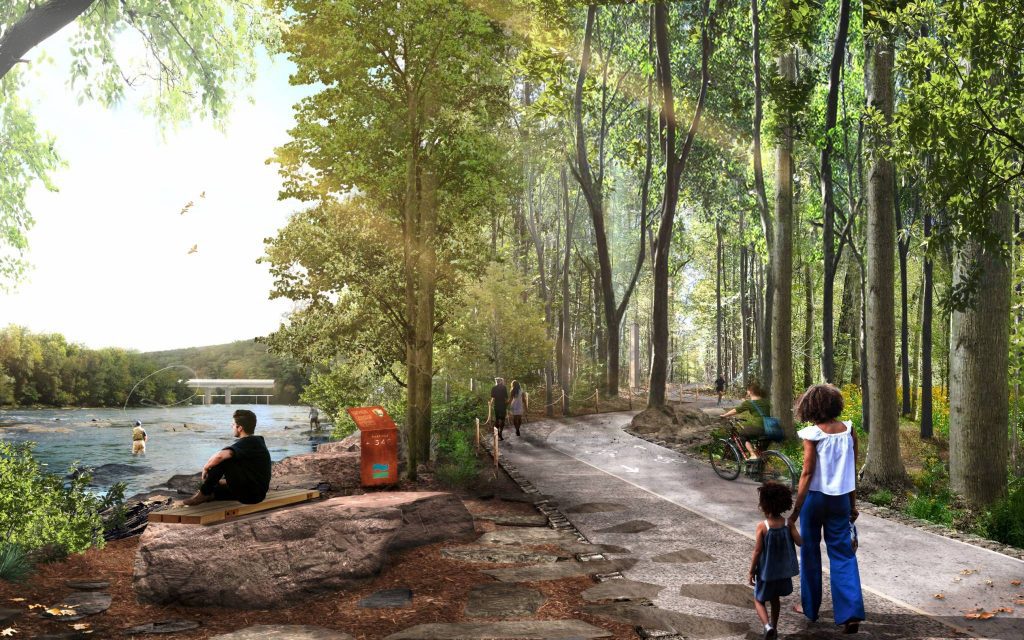
Connected trails, new parks, and an active public realm will provide opportunities for better health, physical activity, transportation, private reflection, and community cohesion. Thoughtful improvements in existing spaces and new connections will transform park and trail access for all.
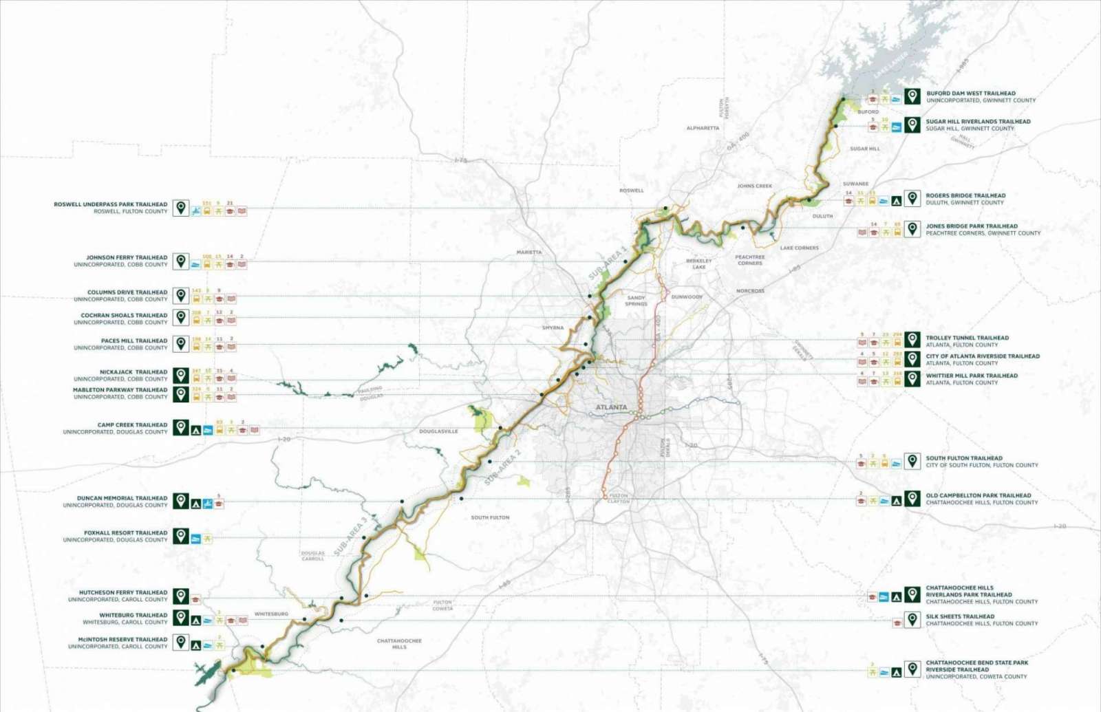
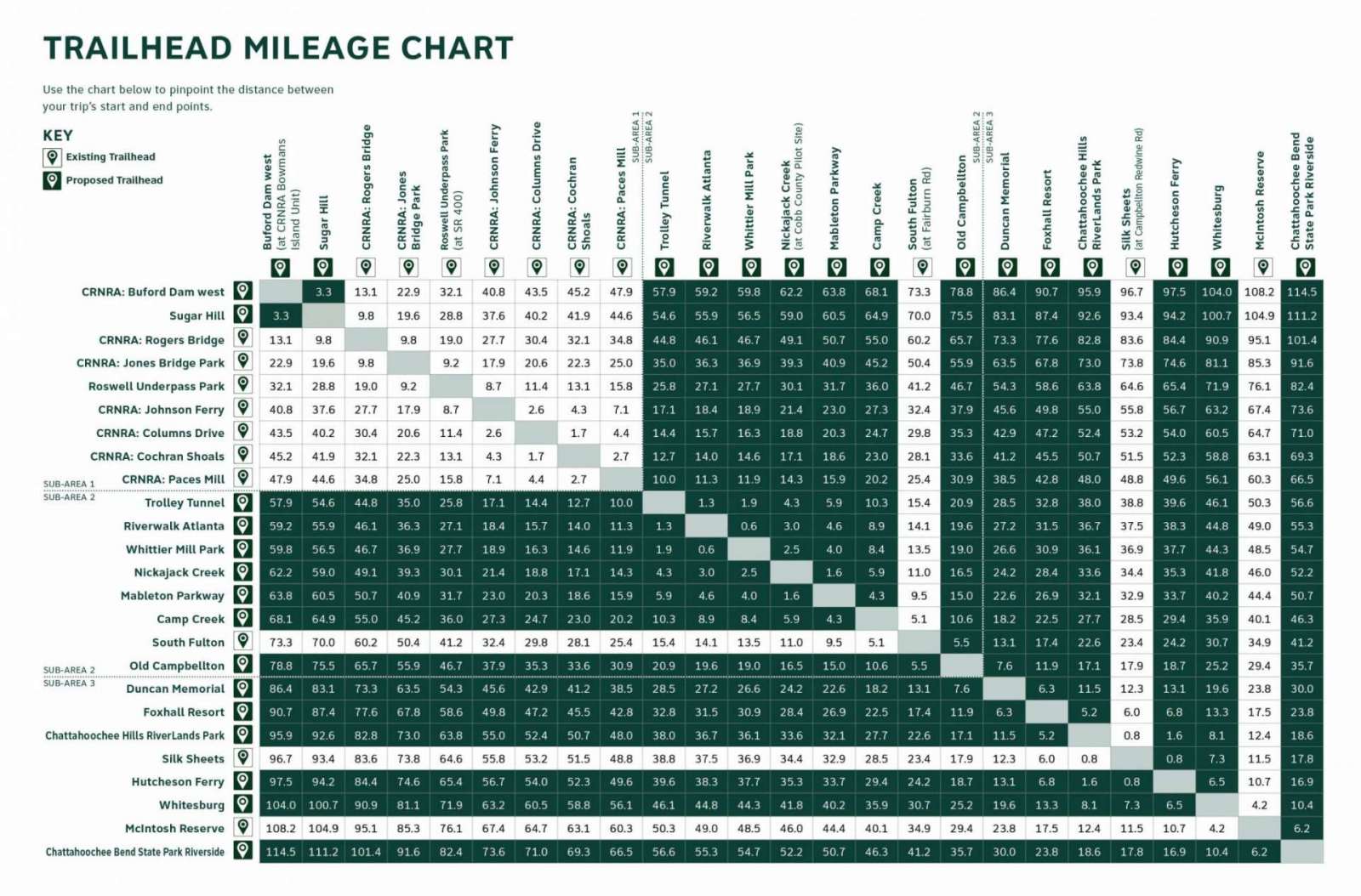
With 25 new or improved river crossings, the Greenway maximizes connectivity between River parks, River communities, River destinations, and the waterway itself. The Greenway is a continuous 125-mile multi-modal trail that follows the River and connects 19 cities across seven counties. In only a 15-min bike ride, the RiverLands will be accessible to more than 1 million residents of the Metro Atlanta Region. With 25 new Trailheads proposed along its length, the Greenway has been carefully designed to balance needs for access and conservation.
Moving forward, there are several trailhead guidelines that can help establish what amenities work best in specific contexts. The Project Team recommends establishing two standard types of trailhead – one geared toward pedestrian access, and one geared toward vehicular access. Each should identify preferred features that best suit the RiverLands and local context. Recommended features to consider include gateway markers, information kiosks, vehicular- and/or pedestrian-scale entry signs, directional signage, interpretive signs, seating (formal and/or informal), shade structures or trees, parking at major trailheads, and where appropriate, comfort stations with plumbing.