/-84.650060,33.683860,12/300x186@2x?access_token=pk.eyJ1IjoibHpjYW11dGkiLCJhIjoiY2o3a281dWJvMHE4ajMzbGF4enJyNHRiciJ9.DhYjvPk5E_wJvys5DU5v2A)
A Continuous Public Realm
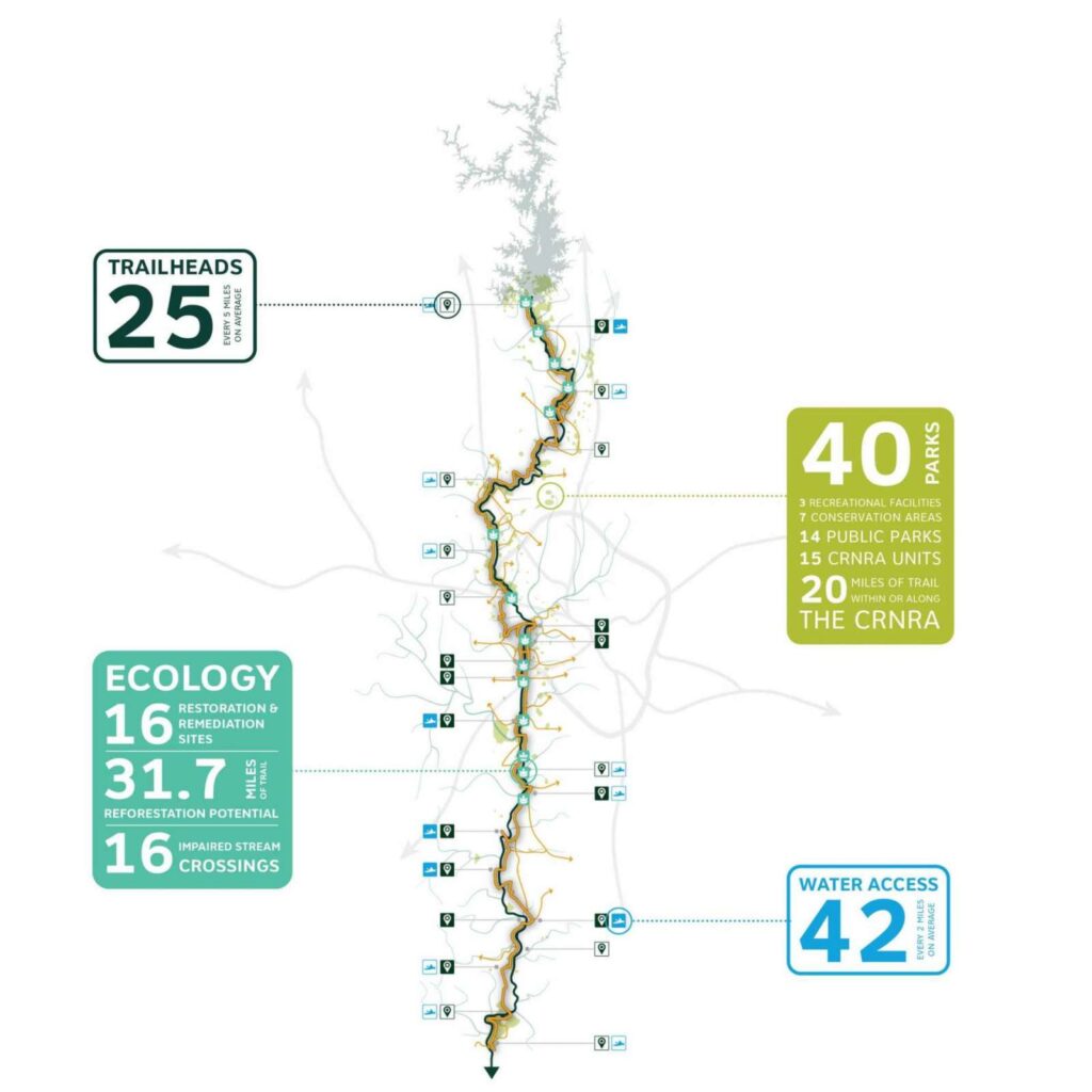
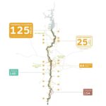
The Chattahoochee RiverLands proposes to use existing and new access points to the River with 25 trailheads and 42 new water access points
The trailheads, located every 5 miles on average, will connect 40 existing parks along its length, half of which are part of the Chattahoochee River National Recreation Area. By connecting these resources, the Greenway boasts approximately 32 miles of restoration potential with 16 sites identified as in need of remediation and/or restoration and 16 impaired stream crossings.
The increase in water access points to a total of 42, and located every 2 miles along the river on average, will provide RiverLands visitors greater access to the Chattahoochee for boating, floating and fishing.