/-84.093153,34.125687,12/300x186@2x?access_token=pk.eyJ1IjoibHpjYW11dGkiLCJhIjoiY2o3a281dWJvMHE4ajMzbGF4enJyNHRiciJ9.DhYjvPk5E_wJvys5DU5v2A)
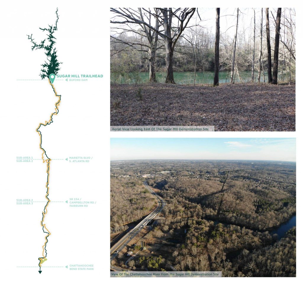
Sugar Hill Trailhead
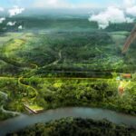
The Gateway to The RiverLands
The Sugar Hill Trailhead will be the Northernmost entrance to the RiverLands and represents a unique opportunity to develop trail amenities that will be iconic throughout the region.
The site for the Sugar Hill Trailhead is situated next to State Route 20 (Cumming Highway), making it a highly visible location for trail-related amenities. Nestled among some of the northern most areas of the Chattahoochee River National Recreation Area, it also offers opportunities to support ecological restoration alongside the trail. This site’s proximity to a variety of destinations, including the planned Sugar Hill Loop, Lake Lanier, and a historic fish weir, is also considered an asset.
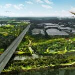
The design goals for the Sugar Hill Trailhead center around a desire to provide trail access to a wide range of users, while also providing amenities that can be replicated throughout the project area. In order to achieve this, the Design Team discussed potential site features including parking, a new boat ramp and wayfinding elements, extensively with a committee of stakeholders.
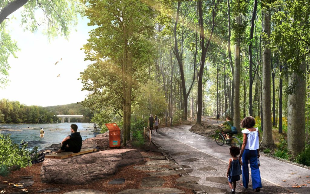
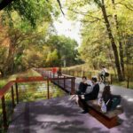
Throughout much of the RiverLands where proximity to the Chattahoochee has defined and driven the decisions about the trail alignment, it will be important to create moments to pause and experience the River. Inspired by the shoals and the geologic formation of the Chattahoochee River, this scene from the Sugar Hill Trailhead provides an example of how the trail will be experienced as an extension of the River itself.

This illustration does not constitute a design proposal nor should it set any expectation for implementation
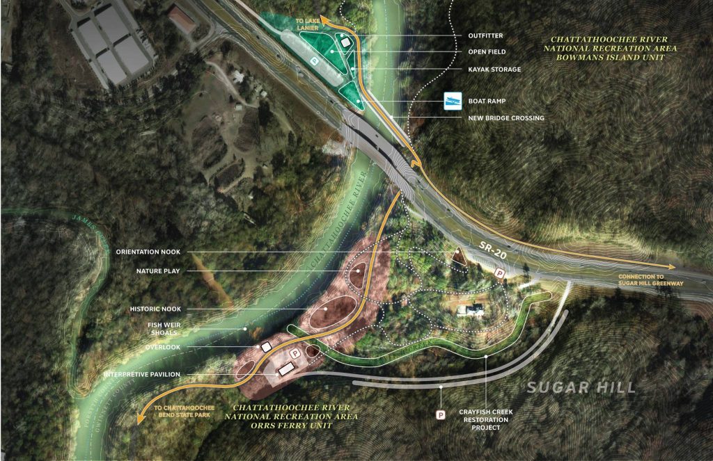
The Project Team met with stakeholders to discuss the programming potential of the Sugar Hill Trailhead Demonstration site. Based on those conversations, the programmatic amenities reflected in the design for this site include:
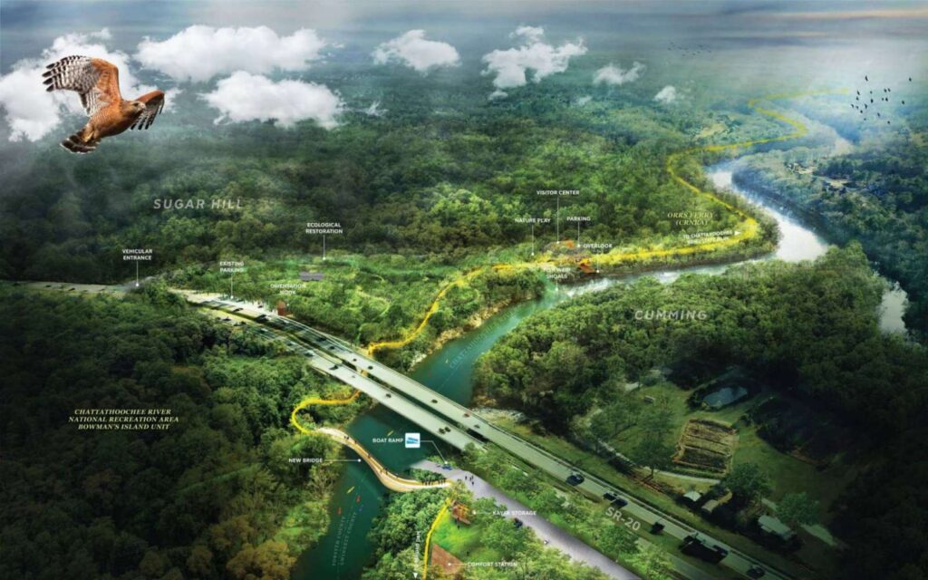
- A new boat ramp, kayak storage, and Blueway specific parking on the West side of the River, directly North of the SR-20 Bridge
- A new pedestrian and cyclist specific bridge across the Chattahoochee in order to bypass heavy traffic on SR-20
- Areas and overlooks along the River to observe and learn about the historic fish weir at Bowman’s Island
- An expansion of the existing parking lot along SR-20 with a nook dedicated to orienting visitors to the trail
- An interpretive pavilion and associated parking specific to cyclists and pedestrians
- The Crayfish Creek Restoration Project, an effort to mitigate the hydrologic effects of Buford Dam operations and local stormwater management